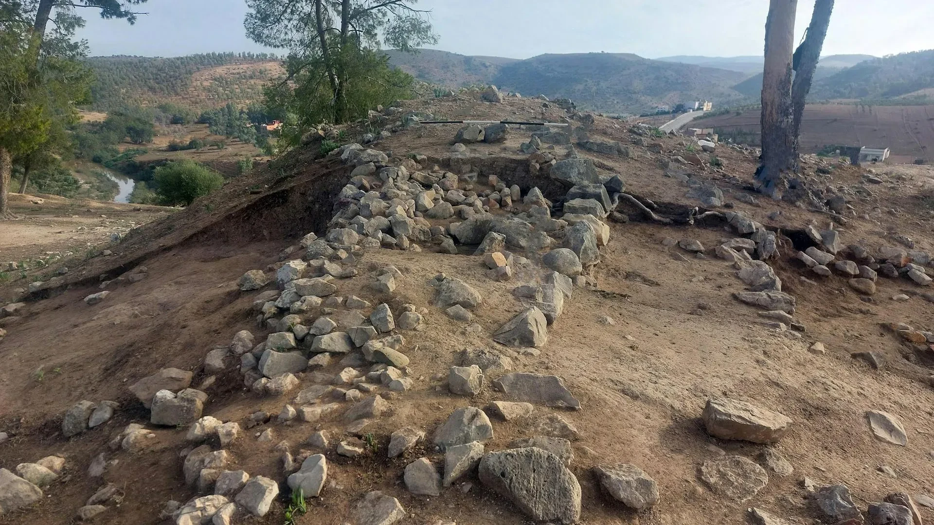
In the rolling hills of north-west Morocco, overlooking the winding river that lends the site its name, archaeologists are peeling back the layers of time at Oued Beht. What was once considered a marginal region in the broader narrative of human history is now emerging as a vital, sophisticated center of activity. Recent excavations at this sprawling site have brought to light a previously unknown chapter of North African heritage, revealing that during the second millennium BC, communities in the Maghreb were not merely surviving—they were actively shaping their environment and participating in a dynamic, interconnected Mediterranean world.
The Oued Beht Archaeological Project has, in recent years, fundamentally altered our understanding of prehistoric Africa. Previous investigations at the site had already identified what is widely considered the largest and earliest agricultural complex ever discovered in Africa outside of the Nile Valley, dating back approximately 5,400 to 4,900 years. However, new fieldwork conducted in 2023 has significantly deepened this narrative, uncovering evidence of organized, large-scale defensive architecture that predates anything previously documented in the region outside of Egypt.
A Prehistoric Hub in the Maghreb
For decades, the later prehistory of the Maghreb—comprising modern-day Morocco, Algeria, and Tunisia—remained a frustratingly blank space in the archaeological record. While the histories of neighboring regions, such as the Iberian Peninsula or the Aegean, were bolstered by robust excavations and clear chronological sequences, evidence from the Maghreb was often fragmentary and difficult to contextualize. This, however, has changed dramatically with the work at Oued Beht.
The site is massive, with human activity spanning at least ten hectares. The earliest major phase of occupation, falling within the Final Neolithic period, highlights a society that was deeply integrated with its surroundings. Environmental data retrieved from the site, including meticulously analyzed plant and animal remains, paints a picture of a flourishing farming community. These early inhabitants were not only cultivating wheat and barley but were also adept at managing livestock and harvesting wild plant resources.
Beyond their agricultural prowess, the people of Oued Beht were skilled craftspeople. Excavations have yielded thousands of polished stone axes, specialized tools, and exquisite pottery, often adorned with intricate painted patterns. While researchers are still debating whether the site functioned as a permanent, year-round village or a seasonal hub for regional populations, its status as a central pillar of the North African landscape during the fourth and third millennia BC is now indisputable.
The Defensive Wall: A Strategic Evolution
The quest to understand the site’s defensive capabilities has a long history, dating back to the 1930s when French archaeologist Armand Ruhlmann first noted the presence of ancient earthworks. Ruhlmann identified a configuration of three walls, with a natural ravine forming a fourth side, creating what he described as a éperon barré, or "barred spur." Yet, for nearly a century, the precise function and date of these structures remained a mystery.
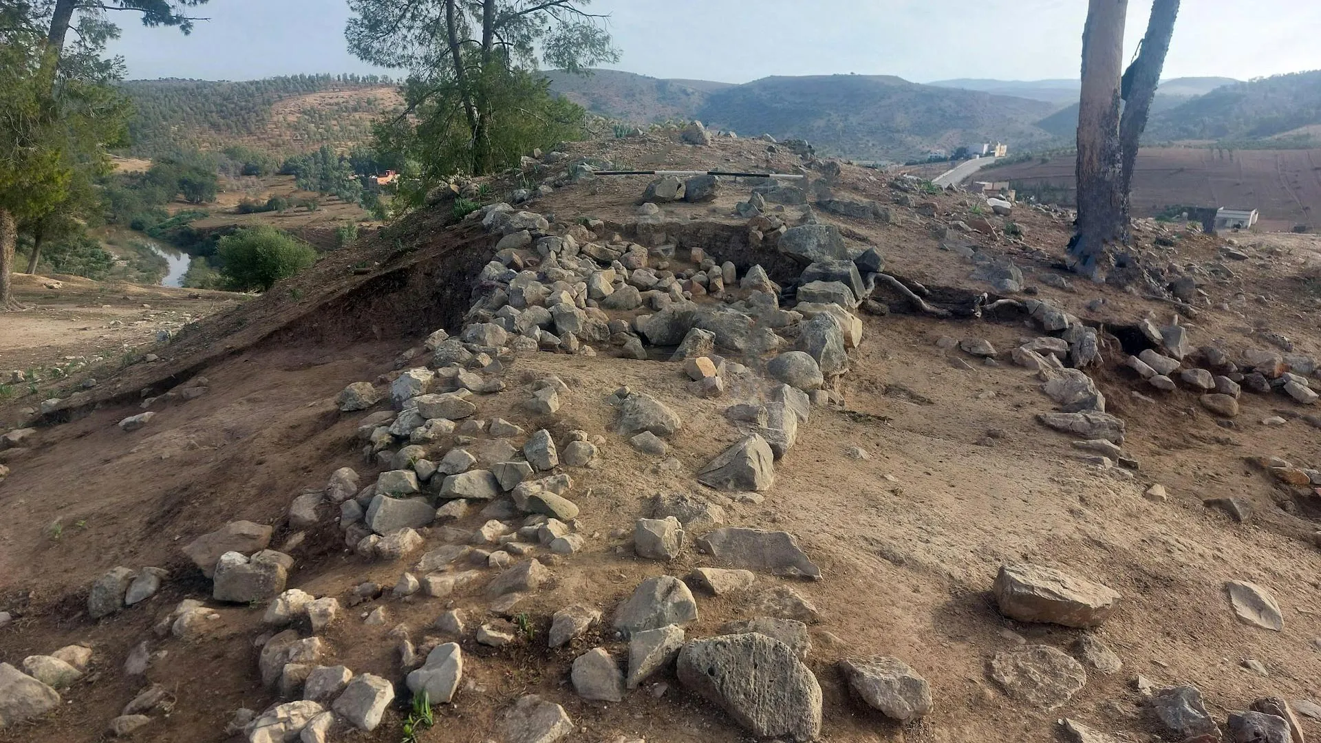
The 2023 excavations have finally provided the answers. Researchers have identified a multi-phase system of ditches, ramparts, and walls constructed across a narrow, strategic section of the ridge situated between the river and a deep ravine. By isolating the southern tip of the ridge, the builders created a protected, highly defensible space. Crucially, radiocarbon dating of the deposits associated with these structures has placed their construction between 4,000 and 3,500 years ago—a timeframe that aligns with the Bronze Age in the wider western Mediterranean.
This discovery is significant, as it marks the earliest confirmed instance of large-scale defensive construction in North Africa beyond the Nile Valley. The implications for our understanding of the societies of the time are profound. The construction of an embankment and ditch system is not a trivial task; it requires high levels of planning, the coordination of labor, and a clear vision of communal security. This suggests that the society at Oued Beht was far more complex and structured than earlier academic models had dared to assume.
Addressing the Threat: Power and Competition
Why would a community in this region feel the need to construct such a formidable barrier? While the historical temptation is to assume the presence of "invaders," the archaeological evidence points toward more nuanced socio-political drivers. The walls were likely built in response to rising competition over land and vital resources, or perhaps as a means to control the movement of people and goods through the landscape.
The shift in the site’s focus is telling. In the earlier Neolithic phase, activity was spread across the more open northern reaches of the settlement. By the time the defensive walls were constructed, the focus of the community had narrowed to the southern ridge. This transition suggests a deliberate change in settlement strategy, perhaps indicating that the community sought to project power, assert control over a strategic high point, or consolidate their defense in an increasingly competitive environment.
Mediterranean Connections and Broader Networks
The developments at Oued Beht did not occur in a vacuum. The second millennium BC was a period of intense transformation across the Mediterranean basin. In southern Iberia, the Argaric culture—flourishing between 2200 and 1550 BC—was building its own complex, hilltop settlements, characterized by planned architecture, sophisticated bronze metallurgy, and rigid social hierarchies.
The similarities between these European developments and the newly revealed structures at Oued Beht are striking. The evidence increasingly suggests that North African communities were not isolated; rather, they were active participants in the wider processes shaping the western Mediterranean. The fortifications at Oued Beht likely reflect the same regional trends of increasing social complexity, the emergence of more formalized leadership structures, and the growing necessity to protect both economic assets and territorial boundaries.
A Landscape of Enduring Importance
The story of Oued Beht does not end with the decline of its prehistoric inhabitants. The site’s strategic value proved enduring, as the ridge became a focal point once again during the medieval period, specifically between the 11th and 13th centuries AD. During this time, the prehistoric defensive structures were rehabilitated and reused, a new hamlet or farm was established on an adjacent hilltop, and a cemetery was constructed between these two areas.
These medieval layers provide a rare, intimate look at the lives of rural communities in a region that has historically been underrepresented in academic literature. The fact that the same ridge was chosen for settlement and defense across such vast stretches of time—separated by millennia—highlights the site’s unique geographical and strategic importance.
As research continues, Oued Beht is poised to become a cornerstone for understanding the evolution of North African societies. By bridging the gap between early farming communities and the medieval rural world, the site challenges us to rethink the history of the Maghreb. It reveals a region defined by innovation, complex social organization, and deep-seated connectivity, reminding us that the deep history of North Africa is not just a peripheral story, but a fundamental part of the human experience. With every new excavation, the walls of Oued Beht are slowly dismantling the myths of isolation and simplicity that have long clouded our understanding of this extraordinary landscape.