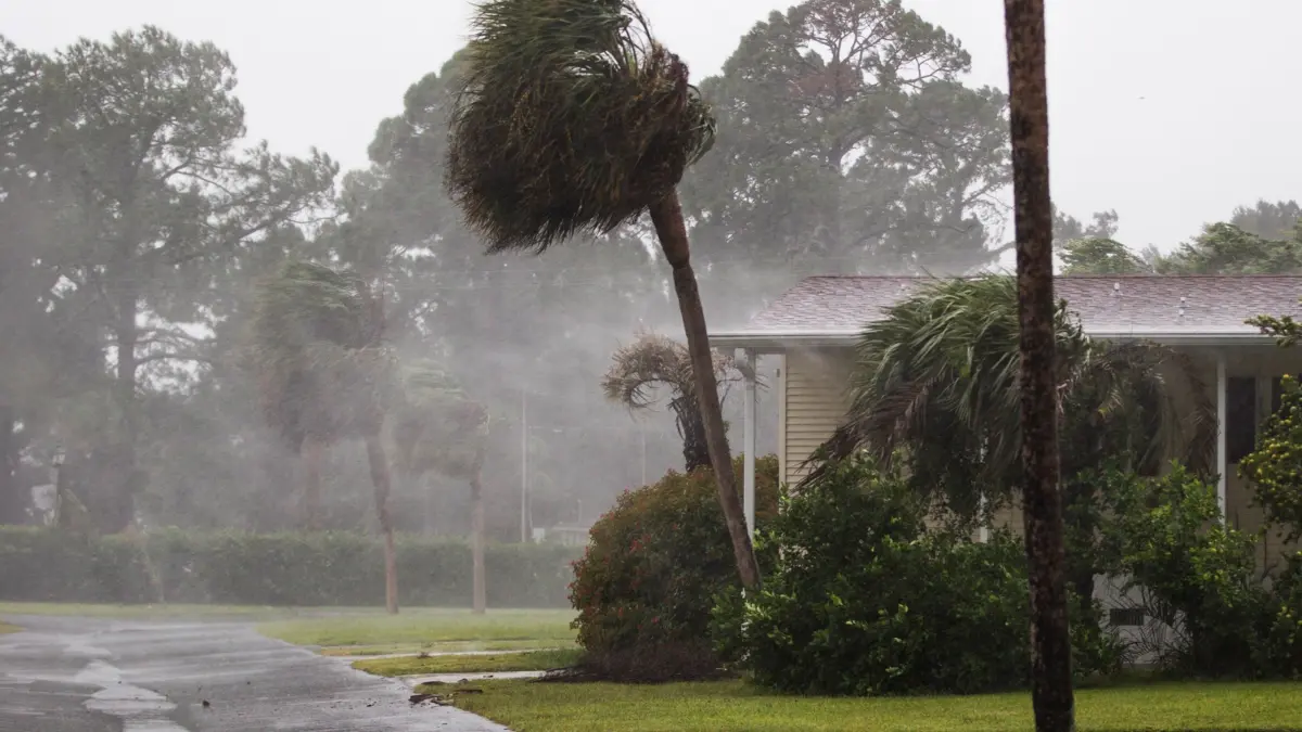
A rapidly developing tropical system in the Gulf of Mexico has put homeowners across Florida and the broader Southeast on high alert, prompting swift government action and urgent preparations ahead of a potentially severe weekend impact.
The National Hurricane Center officially designated the system Tropical Storm Isaias, noting that the storm is intensifying at an alarming rate. Within a 24-hour window, meteorological models indicated a strong potential for the system to reach Category 1 or Category 2 hurricane status by Thursday, which would make it the first official hurricane of the season. With forecasts projecting that Isaias could bring torrential, flooding rains and damaging winds as early as Friday, residents along the coast have been left with a narrow window to secure their properties.
Tracking Tropical Storm Isaias
Forecasters at the National Hurricane Center have raised concerns over an increasing risk of dangerous wind speeds and significant storm surge impacts along portions of the northern Gulf Coast, stretching from Louisiana to the Florida Panhandle.
In direct response to the escalating threat, Florida Governor Ron DeSantis signed an executive order declaring a state of emergency across 25 counties as a precautionary measure. Emergency management officials are urging residents within the projected impact zones to closely monitor local weather updates and heed evacuation or preparedness warnings issued by local authorities.
According to meteorological projections from the Weather Channel, Isaias is expected to transition into a hurricane by Thursday before undergoing rapid intensification into at least a Category 2 storm by Friday evening while moving through the central Gulf. The National Hurricane Center adds that flash flooding and urban inundation, alongside isolated river flooding, will remain major concerns as the system continues to strengthen. Current tracks place potential landfall anywhere between Louisiana and the Florida Panhandle by late Friday night or early Saturday morning.
A Quiet Hurricane Season Upended
The emergence of Tropical Storm Isaias arrives near the tail end of a season that had previously been characterized by relative inactivity. Earlier projections from NOAA’s National Weather Service anticipated a below-average season, predicting a total of seven to 13 named storms.
Isaias marks the ninth named storm of the season and, if it maintains its projected trajectory, will stand as the season’s first hurricane. Earlier predictions of subdued tropical activity in the Atlantic basin were largely attributed to the presence of super El Niño conditions. El Niño events typically foster increased wind shear across the Atlantic and Gulf regions, which acts as a barrier against tropical storm formation and prevents existing systems from organizing and strengthening.
Matt Rosencrans, lead hurricane season forecaster with NOAA’s National Weather Service, explained that when an El Niño emerges, it frequently dictates the overall tempo of tropical activity. He noted that the prevailing El Niño conditions had continued to strengthen on a monthly basis prior to this sudden shift.
Preparing for Severe Weather and Heavy Rainfall
Despite the broader seasonal forecasts, meteorologists and emergency officials emphasize that it only takes one active system to cause widespread disruption. Homeowners across the region are reflecting on the lessons learned from earlier weather events, including Tropical Storm Arthur. Though Arthur was a relatively brief system earlier in the season, it still delivered heavy rainfall and triggered flash-flood emergencies across the Southeast through mid-June.
Numerous properties suffered damage from gusty winds and relentless downpours, while several communities recorded historic rainfall totals. Notably, New Orleans shattered a 70-year daily rainfall record on June 18, accumulating 7.75 inches of rain and easily surpassing the previous record of 1.74 inches set in 1957, according to Weather Channel data.
With similar threats looming, experts advise residents in Florida, Louisiana, and surrounding southeastern states to use the remaining time before the weekend to safeguard their homes. Standard precautions recommended by emergency management professionals include testing sump pumps, inspecting septic systems, and ensuring that household members know the exact locations of main water, electrical, and gas shut-off valves in the event of utility disruptions.
Property experts also highlight the importance of inspecting and clearing home drainage systems—a step that is frequently overlooked outside of the traditional spring cleaning window. Chris Counahan, president of LeafFilter, noted that homeowners living in regions vulnerable to torrential downpours should maintain an active maintenance schedule for exterior drainage.
"Drains are meant to direct water away from the home, so it is important to keep these areas clear of debris," Counahan explained, warning that neglected gutters and blocked outdoor drains can lead to severe water intrusion, compromised home foundations, and localized flooding. While routine upkeep can often be managed by homeowners, Counahan advises that heavy blockages or deep debris accumulation may require professional intervention to ensure proper drainage before severe weather arrives.